Wards Profile and Key Demographic
Following the newly redrawn Toronto District School Board (TDSB) maps, for the October 26, 2026 municipal election, Spadina-Fort York (previously ward 10) and Toronto- Danforth (previously ward 14) have been combined together to form the new Ward 5.
My team will leverage extensive multi-sector research to develop compliant, cost-efficient solutions that enable schools to implement policy mandates without operational disruption.
Through rigorous analysis and evidence-based methodologies, I will facilitate measurable performance improvements that demonstrate accountability to stakeholders and optimize resource allocation.
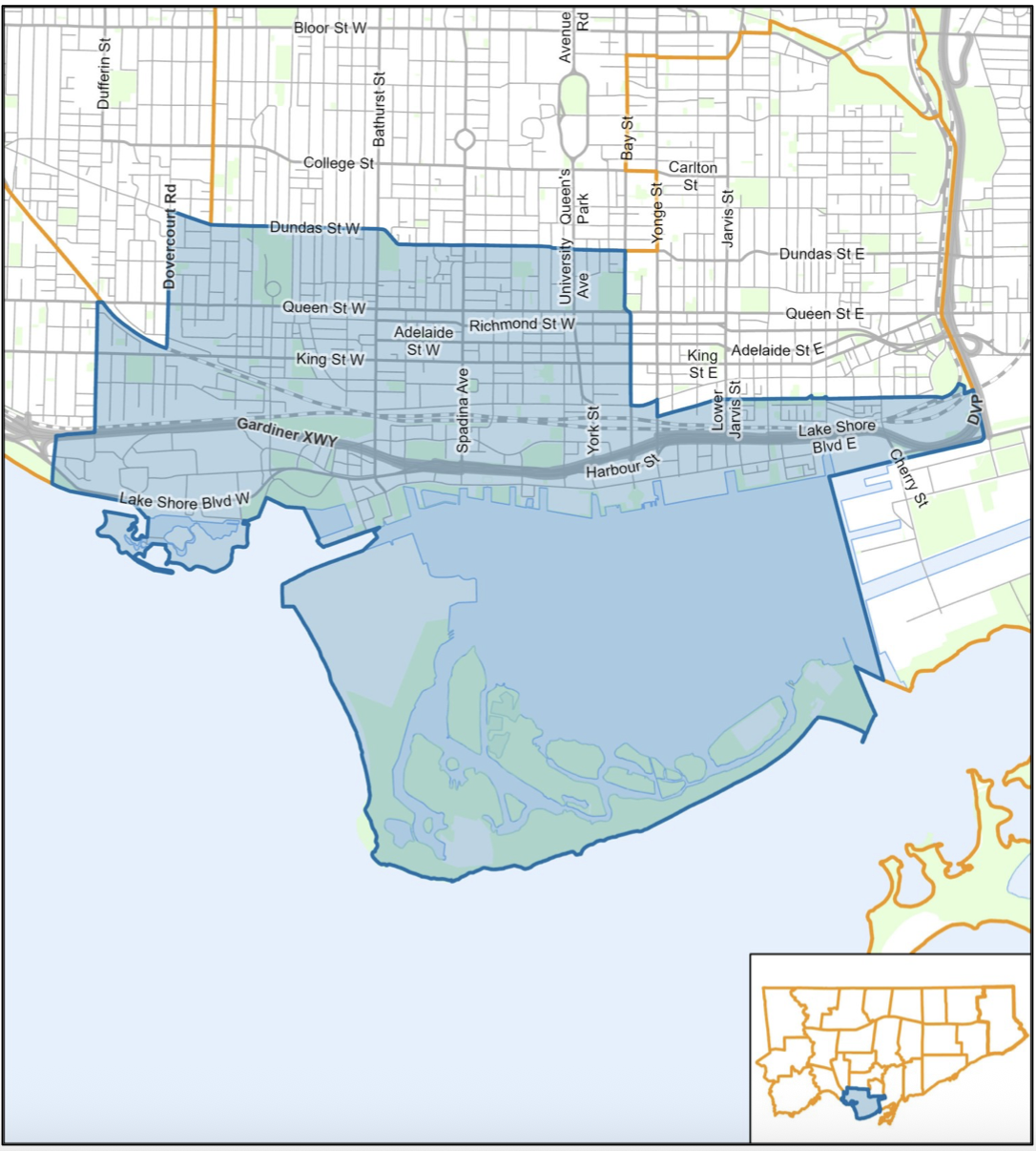
Spadina-Fort York Existing Boundaries
Ward 10
Spadina—Fort York in Toronto is bounded by Lake Ontario to the south, Dundas Street, Bay Street, and The Esplanade to the north, Winona Drive, Ossington Avenue, and Dundas Street to the west, and the Don River and Port Lands to the east.
Ward Boundaries
North: Dundas Street, Bay Street, and The Esplanade.
South: Lake Ontario, including the Toronto Islands.
West: Winona Drive, Ossington Avenue, Dundas Street, and Davenport Road.
East: The Don River and the Port Lands
Key Neighbourhoods Included
Fort York and Cityplace
Entertainment District and King West
Chinatown and Alexandra Park
The Distillery District and Corktown
Toronto Islands
This ward consists of 135, 400 people, with 80, 730 dwellings (households) as of the 2021 census. The median family household size is 1.68.
Sources: City of Toronto; Wikipedia
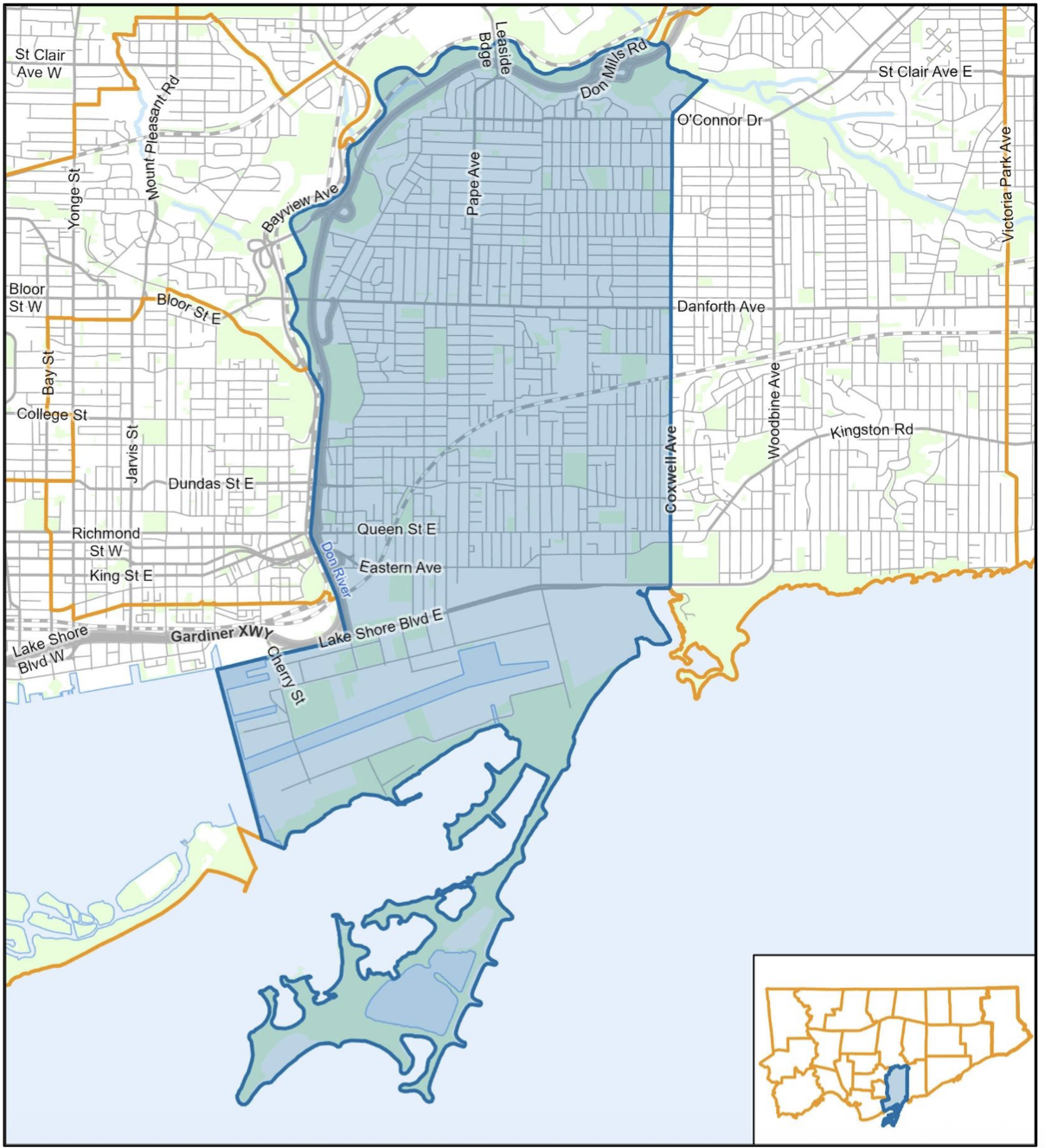
Toronto-Danforth Existing Boundaries
Ward 14
The boundaries for Toronto–Danforth (which mirror the federal riding, provincial district, and municipal Ward 14) are bordered by the Don River on the west, Lake Ontario on the south, Coxwell Avenue on the east, and Taylor Creek/Don River East Branch on the north.
Detailed Boundaries
South: Lake Ontario and the Toronto Harbour (including the Port Lands and Cherry Beach).
West: The Don River, stretching north from the inner harbour up the valley.
North: Taylor Massey Creek (Taylor Creek) and the Don River East Branch.
East: Coxwell Avenue (and Coxwell Boulevard) south down to Lake Ontario.
Key Neighbourhoods Included:
Riverdale (North and South)
Leslieville and Riverside
Greektown
Playter Estates
Blake-Jones
Port Lands
This ward consists of 104,555 people, with 46,235 dwellings (households) as of the 2021 census. The median family household size is 2.26.
Source: City of Toronto; Wikipedia
Initiate Your Civic Engagement
Complete the brief form today to enable your candidate to evaluate your needs and prepare a comprehensive, obligation-free proposal.